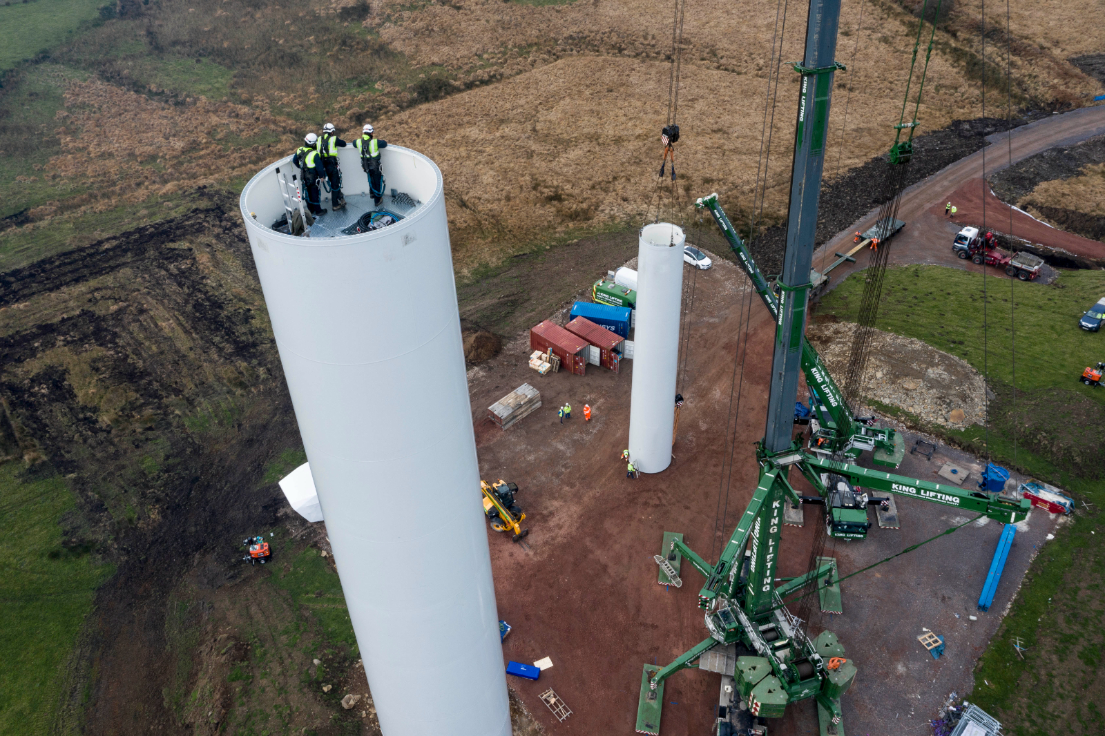
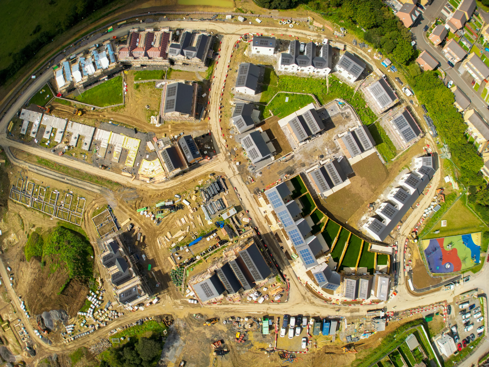
Quarry And Landfill Drone Surveys
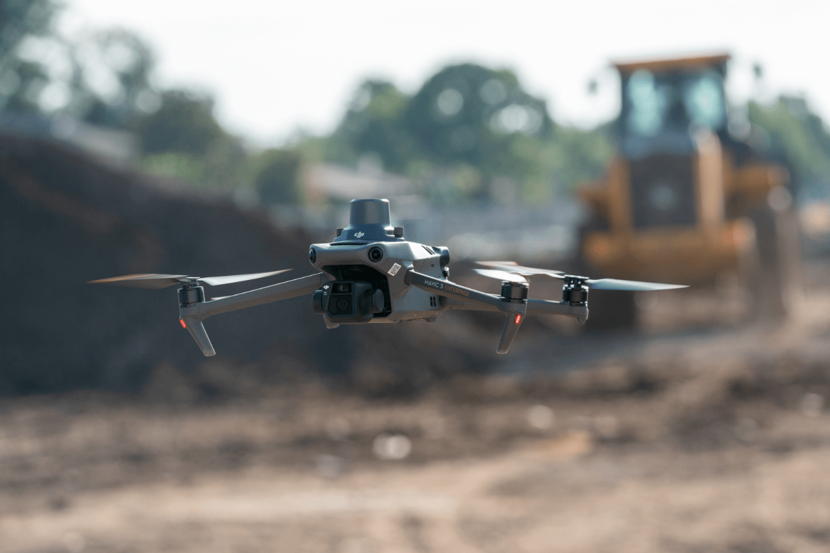
Our team of professionals uses advanced UAV technology and software to capture high-quality images and data.
The collected data is then used to create detailed and accurate mappings of your site. Importantly, our drone surveys provide a safe, cost-effective alternative to traditional surveying techniques.
By utilising state-of-the-art technology, we can access hard-to-reach areas. This ensures complete coverage and precision. Rely on Drone Surveys Cardiff to deliver reliable and efficient surveying solutions.
Quarry and Landfill Drone Services We Offer
We offer a range of services beyond aerial surveying. Our skilled team uses drone technology to track work progress. They help to enforce safety regulations and collect essential data for our clients.
We provide detailed reports and high-resolution imagery to support decision-making processes. All these and more form part of our commitment to provide the best service in the industry. For more information, please contact us.
Aerial Surveying
Topographic Mappings
Stockpile Measurements
Visual Inspections
Progress Reporting
Safeguard Monitoring
Site Planning
Volume Analysis
Damage Assessment
Landfill Evaluation
Evaluating and Monitoring Landfills And Quarries
Using drones in evaluating and monitoring quarries and landfills has changed the industry. It provides more accurate measurements, resource management, and safety regulations enforcement.
We make this possible by delivering clear data to assist in your decision-making processes. Our fleet of state-of-the-art drones captures high-resolution images and videos.
These allow you to have the most detailed insights into your sites. This technology reduces the need for manual inspections, which enhances safety and efficiency.
Trust Drone Surveys Cardiff to provide drone solutions tailored to your specific needs.
Why Drones Help Assess Quarries and Landfills
Drones are useful for inspecting quarries and landfills as they provide a thorough overview of the site in a short time. They collect accurate data. This will help improve ongoing work efficiency and future project planning. Using drones for these assessments reduces labour costs and the risk of injury.
By using advanced imaging technology, drones can capture high-resolution images and videos. These can be analysed to identify potential issues or areas for improvement. This data is used to create detailed maps and 3D models of the site.
Drones can access hard-to-reach areas. This ensures a more precise assessment without putting workers in dangerous situations. quarry and landfill aerial survey leverages drone technology to optimise site assessments, ensuring safety, accuracy, and cost-effectiveness.
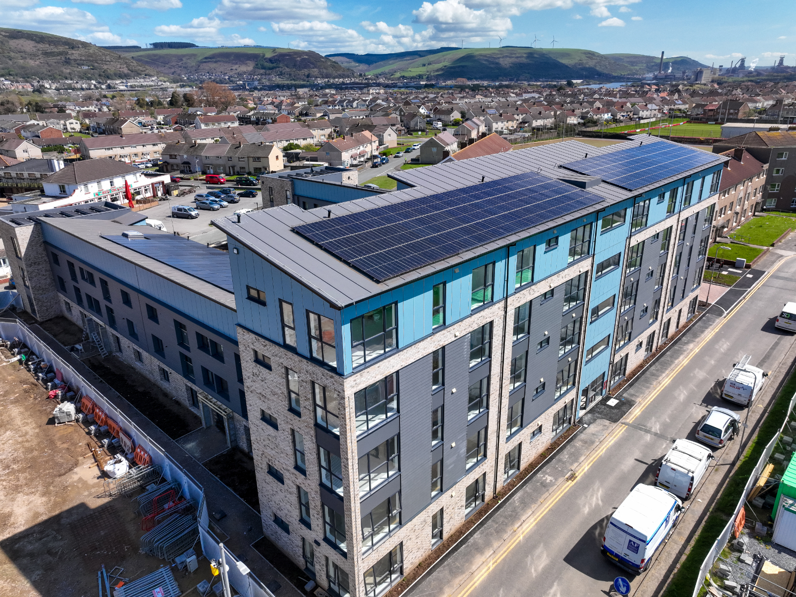
Drone Property Photography Cardiff
At Drone Surveys Cardiff, we offer drone property photography services, utilising cutting-edge technology to capture stunning aerial imagery of your real estate listings. Our drones provide a unique perspective, showcasing UK properties in their full splendour.
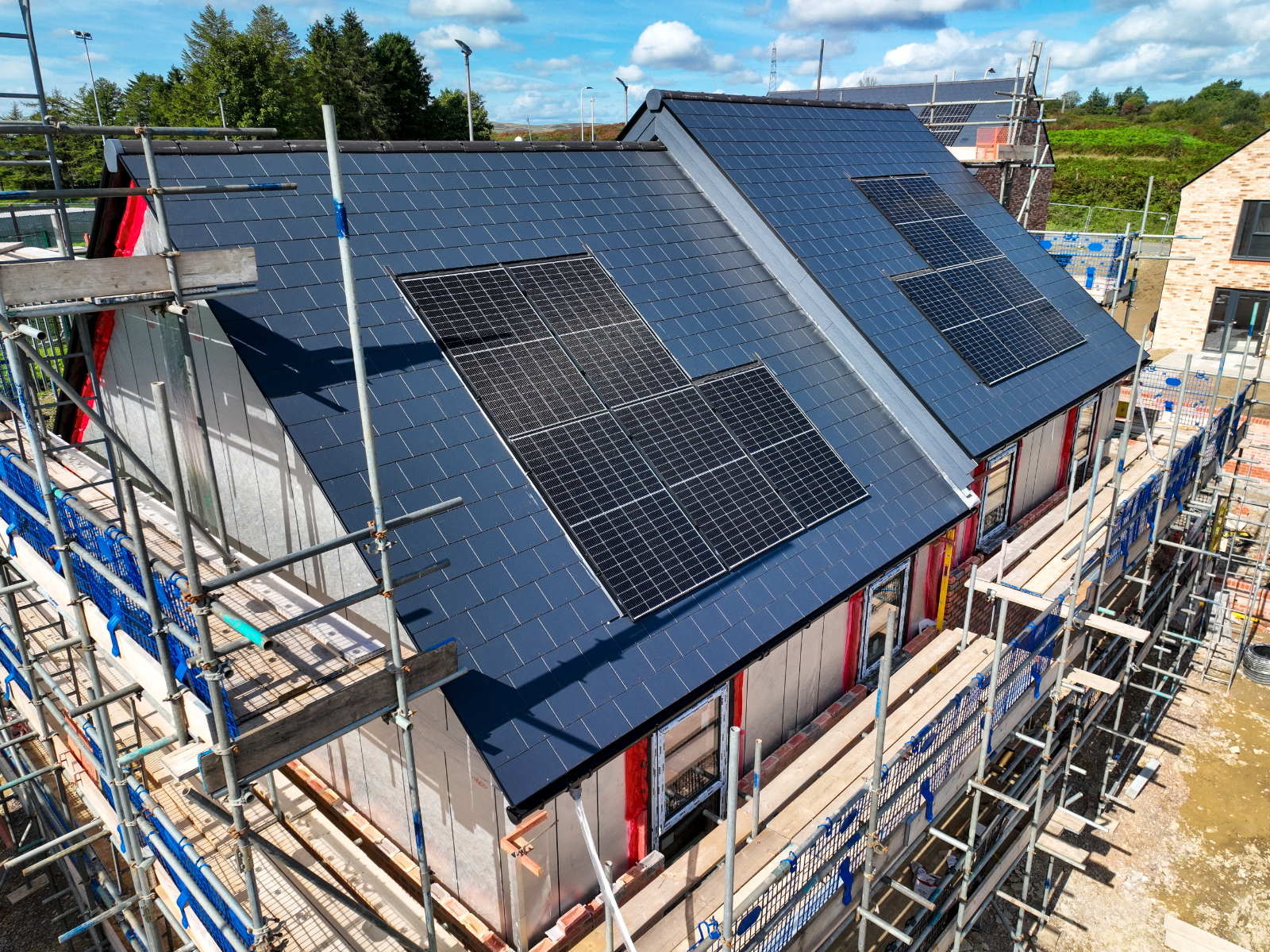
Aerial Roof Inspections Cardiff
We use the latest, highest-quality drones to provide thorough examinations of rooftops. Our specialised team, proficient in drone technology, ensures precise assessments to identify and address potential issues promptly.
Drone Surveying Cardiff
Discover the excellence of our Drone Surveying service. Employing advanced UAV technology, our skilled team provides precise, comprehensive surveys for various industries. Count on us for accurate, efficient, and insightful data collection.